 |
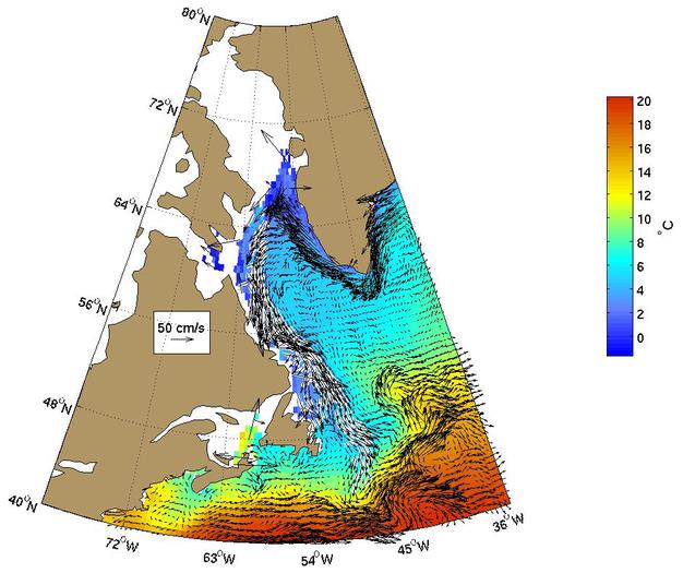
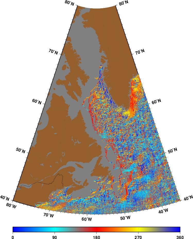
Figure 1.
The Labrador current as represented by the Mariano Global Surface Velocity
Analysis (MGSVA). The Labrador Current is the "southward" flowing
component of the N. Atlantic subpolar gyre. It transports cold waters
into the warmer Gulf Stream ring and meander region.
Click here for example plots of
seasonal averages.
|
|
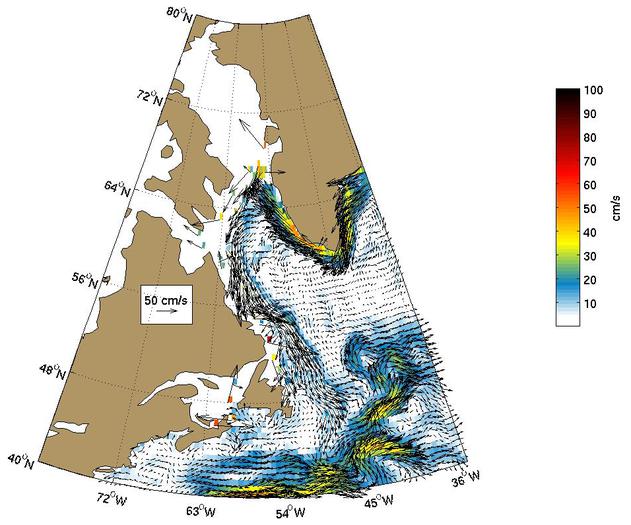
Figure 2.
Global Ocean Surface Velocities from Drifters
(top panel w/ SST, bottom panel w/ Speed)
Figure Caption is Under Construction.
Click here for example plots of
seasonal averages.
|
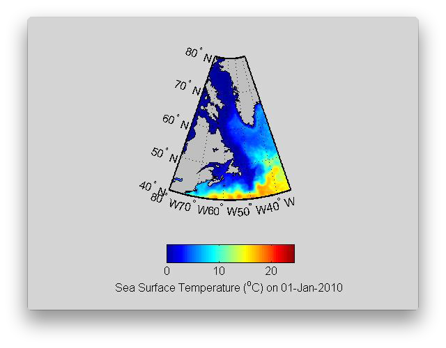 |
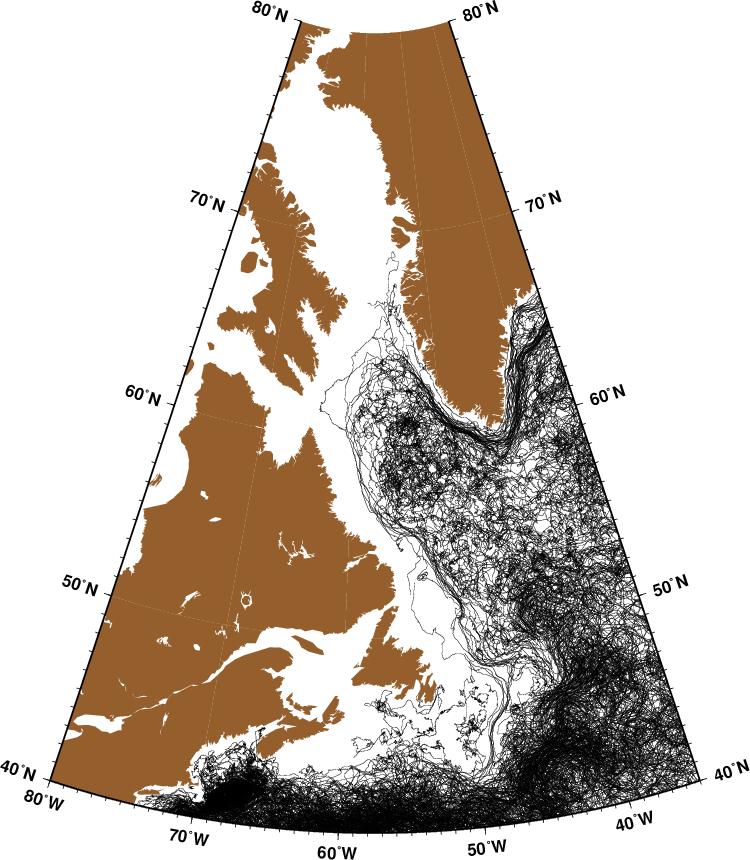
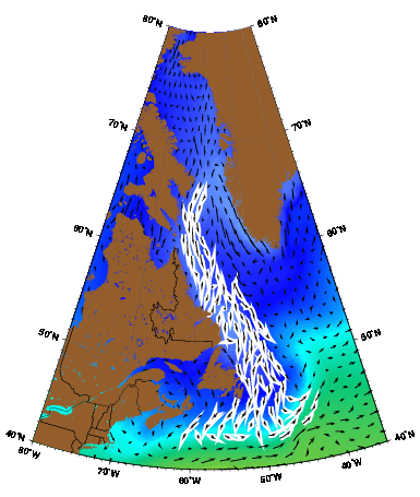
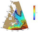
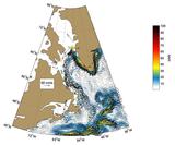
Figure 3.
The Labrador Current is found offshore of the northeast coast of Canada
at the boundary between the coldest polar water and cool water. The Labrador Current transports cold water southward from the Labrador Sea
towards the Gulf Stream and into the Slope Water. This cold water transport is most visible in late spring and in the fall.
( Click the thumbnail to play the animation. )
|
 |
Figure 4.
|
 |
Figure 5.
|
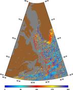 |
Figure 6.
|
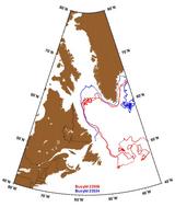 |
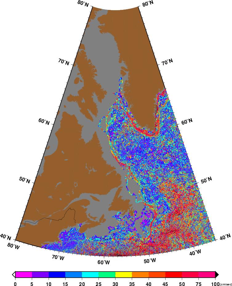
Figure 7.
Trajectories of buoys, ID 23508 (red) and 23534 (blue), exhibit the
well-know counter-clockwise subpolar gyre circulation of the East Greenland
Current, the West Greenland Current, and the Labrador Current. Buoy 23508
was in the Labrador Current twice; during the summer and fall of 1996 and in
the fall and winter of 1998-99. It completed nearly one and three-quarters
of a loop around the North Atlantic subpolar gyre (Also see the text of
Irminger Current Figure 7.).
Buoy 23534 was initially in the local
recirculation in the north-east corner of the subpolar gyre before
being advected by the East Greenland, West Greenland, and Labrador Currents.
|
 |
Figure 8.
AVRRR image of the sea-surface temperature (SST).
|
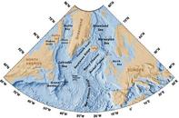 |
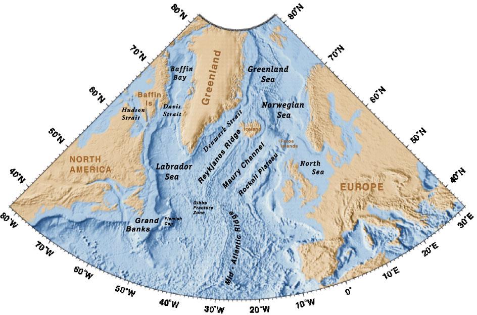
Figure 9.
Geography of the region.
|
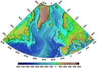 |
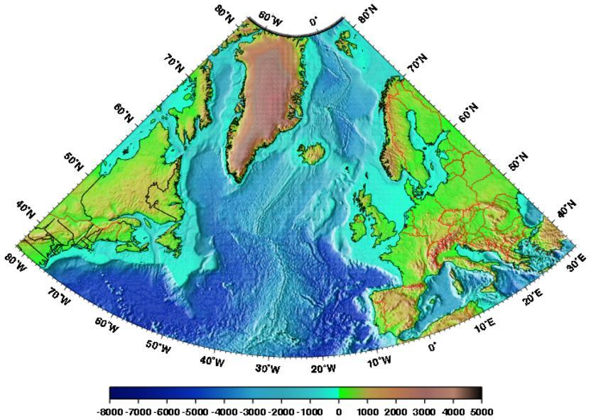
Figure 10.
Topography/Bathymetry of the region.
|