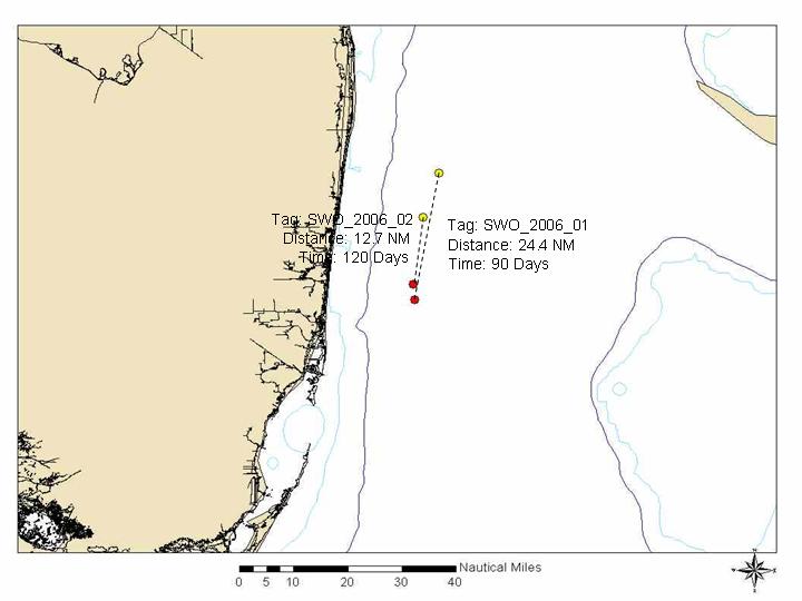
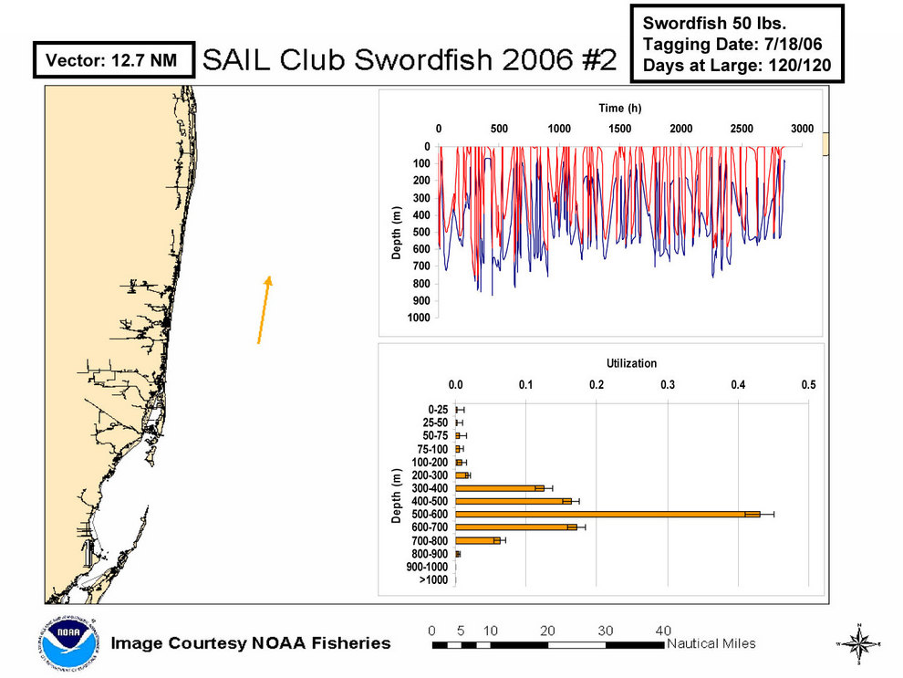
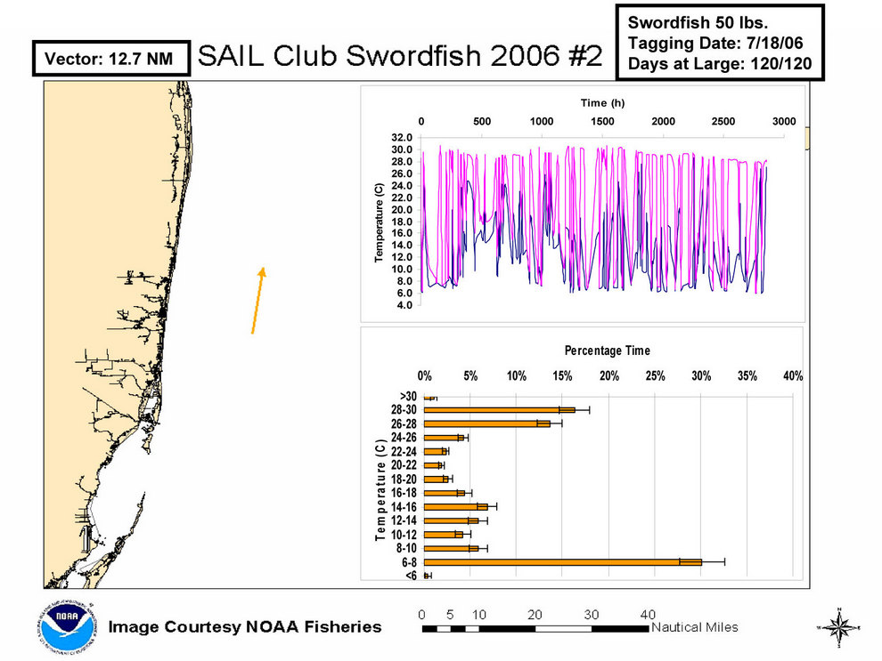
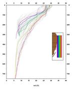
The S.A.I.L. fishing club raised money to purchase three Pop-up Satellite Archival Tags (PSATs) to tag swordfish in the Florida Straits. These tags measure light, pressure/depth, and temperature of the water, store, and then transmits a summary of the this information to a NOAA satellite using the ARGOS system. Dr. Eric Prince's research group from NOAA South-East Fisheries Science Center (SEFSC), Eric Orbesen, Dave Kersetter, and Derke Snodgrass, teamed with Captain Steve Huddleston and local fisherman, most notably Silvio, to tag fish in the summer of 2006.
This data is for public outreach purposes only and for use by swordfish fisherman.