|
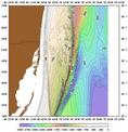
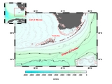
Bathymetry of the Florida Keys
|
|
Ocean Surface Currents South Florida Outreach |
| Bathymetry | Guestbook |
|
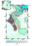
Bathymetry of the Florida Keys Bathymetry of the Bahamas LADS Bathymetry plots of South East Florida Some Example Plots Some More Example Plots Broward County LADS Bathymetry |
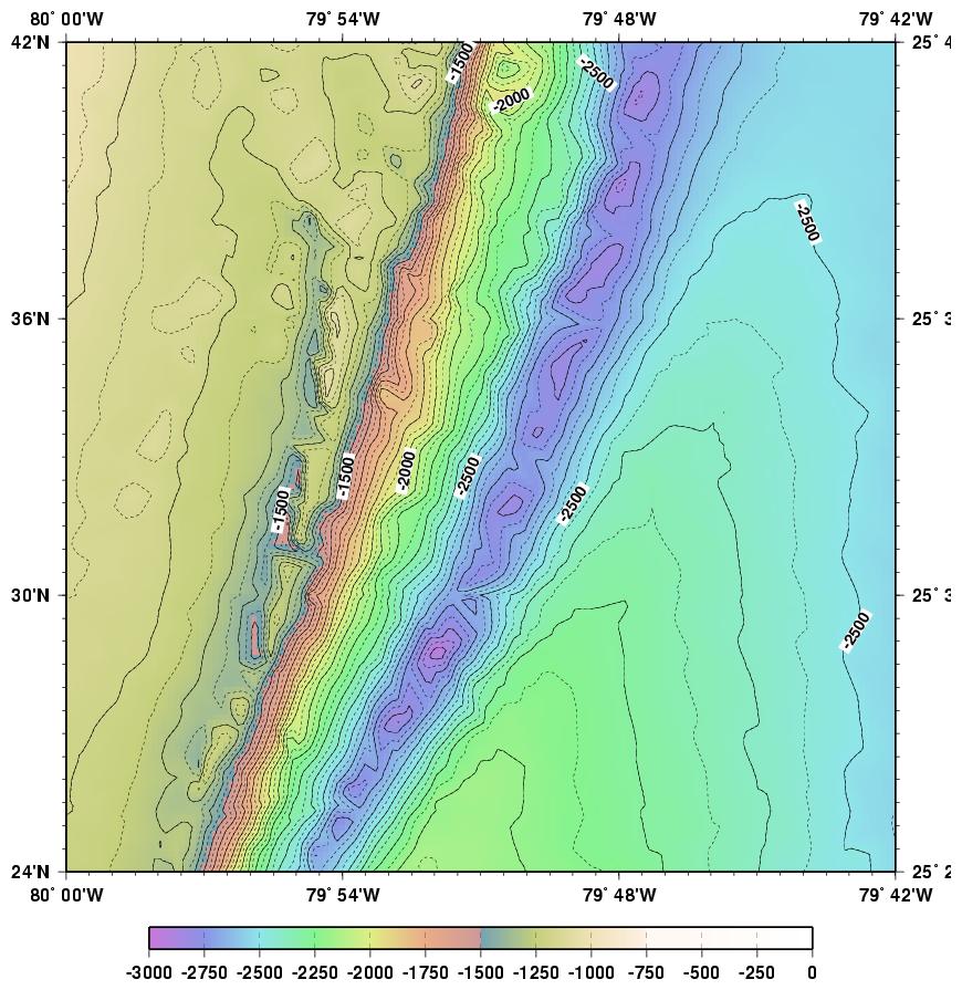
Bathymetry of the Florida Keys
Lower Keys Upper Keys
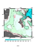
Bathymetry of the Bahamas
Straits of Florida &
Northwest Providence ChannelTongue of the Ocean &
Northeast Providence Channels
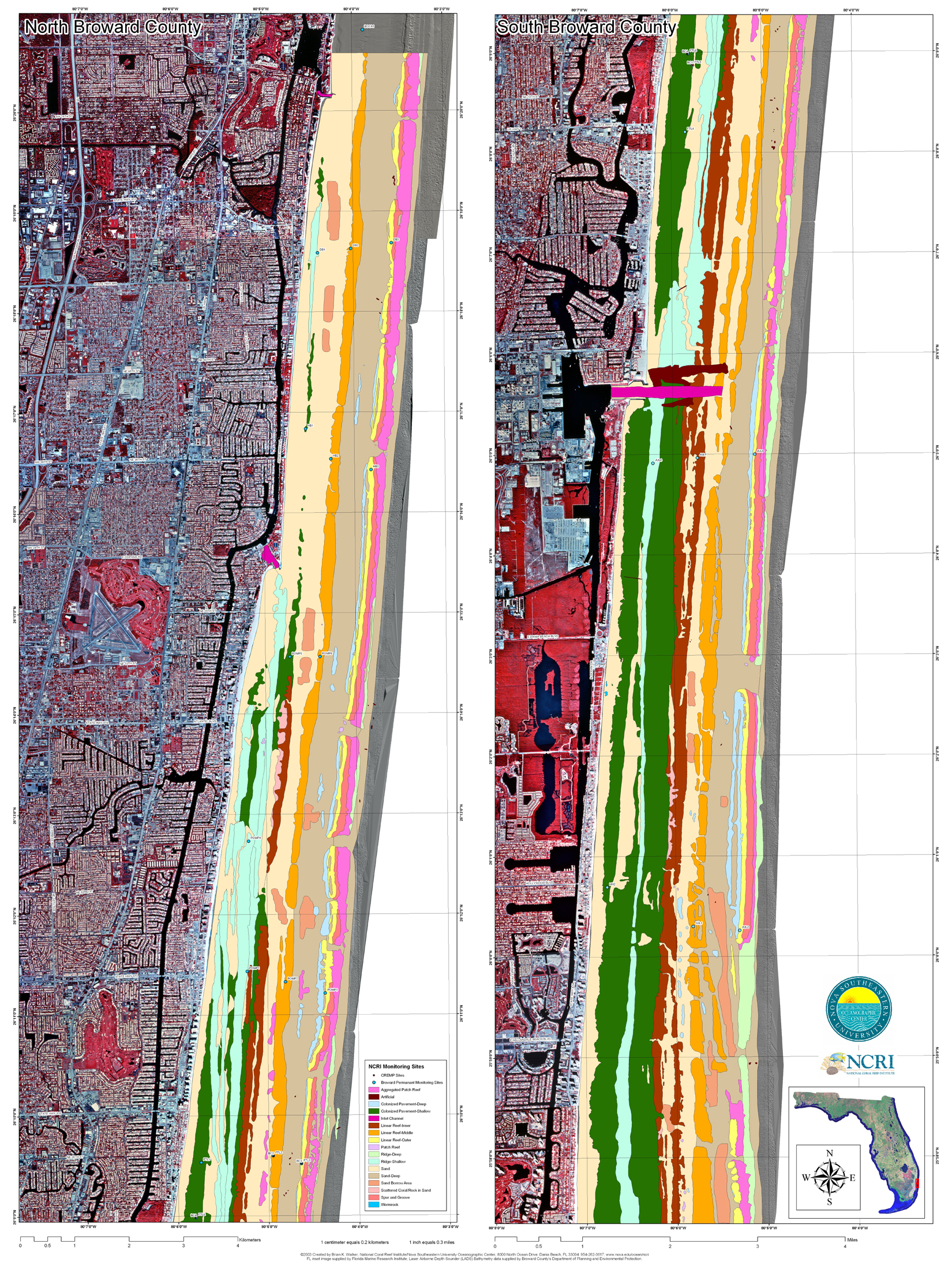
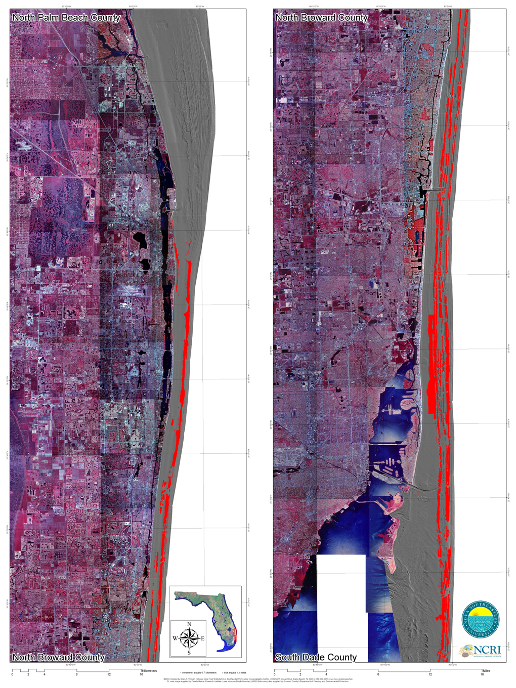
LADS Bathymetry plots of South East Florida (Laser Airborne Depth Sounder)
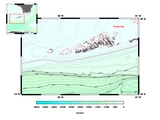
St. Lucie Inlet Aquatic Preserve
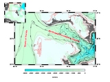
in St. Lucie CountyBroward County
(North)Palm Beach to Broward &
Broward to Miami-DadeCredits
St. Lucie Inlet map: Brian Walker, NOVA University.
The other 2 maps: a joint effert by FDEP, NOAA, FWC and NCRI.
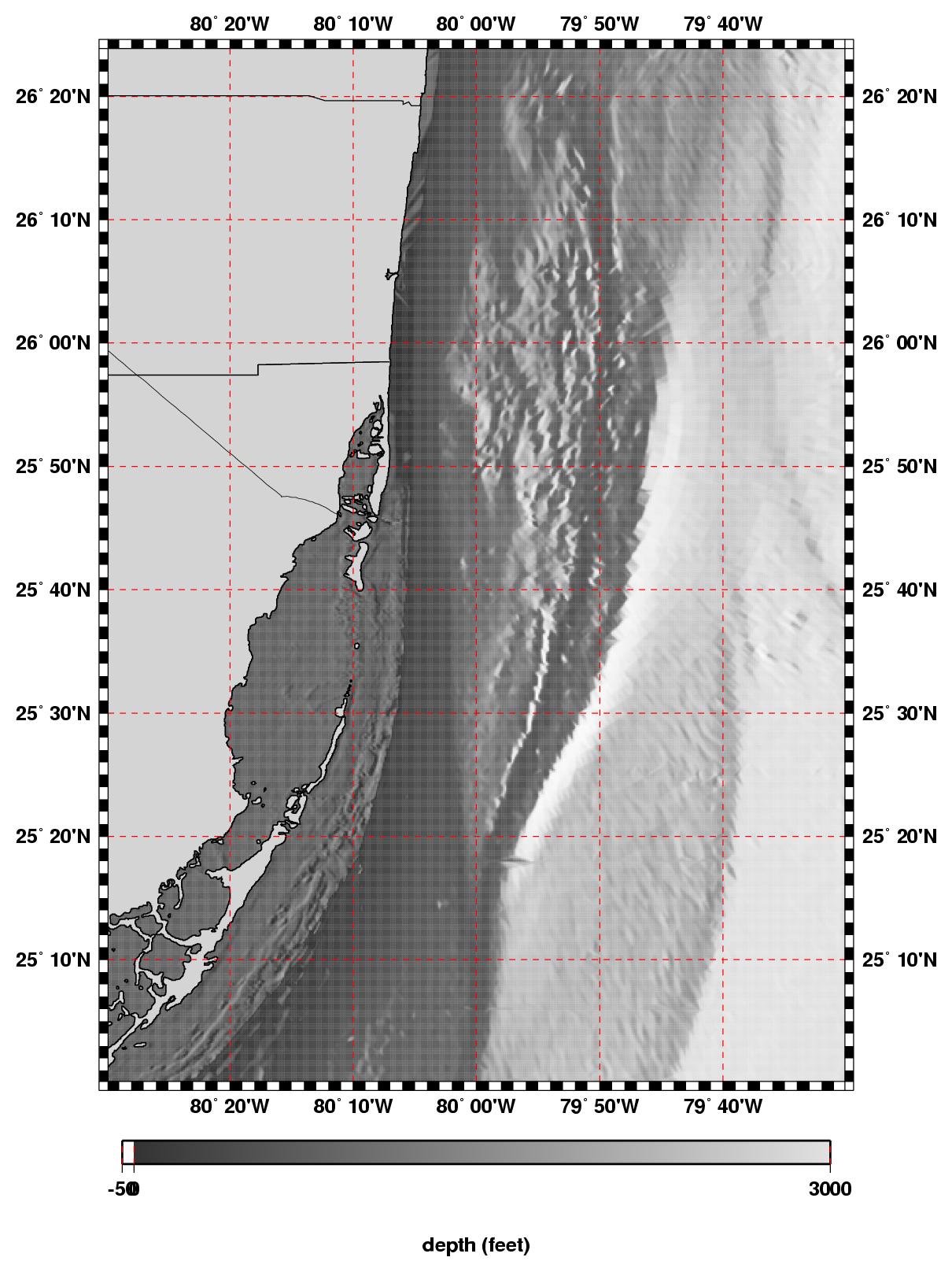
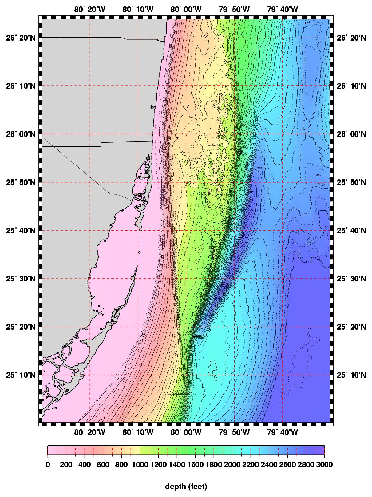
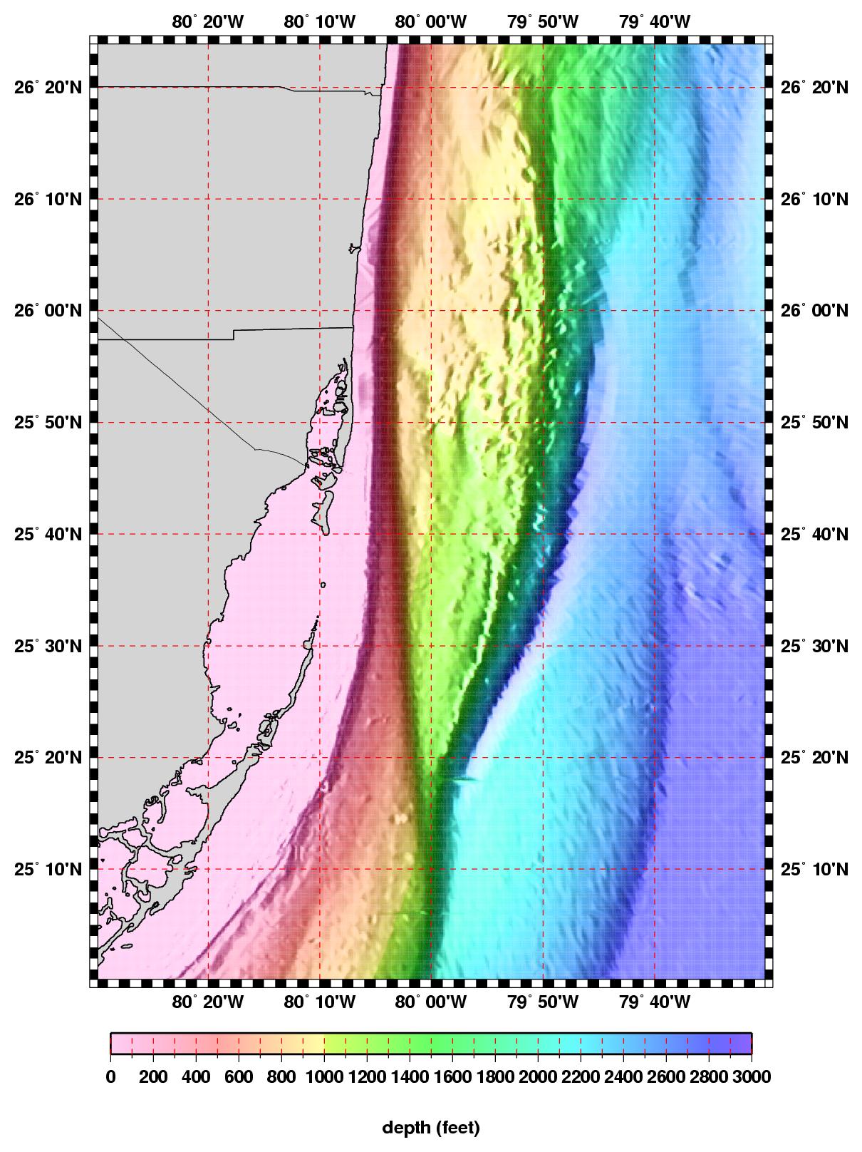
Some Example Plots
shaded
b/wflat
colorshaded
color
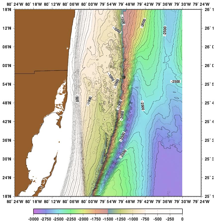
Some More Example Plots
topob.pdf
top/left
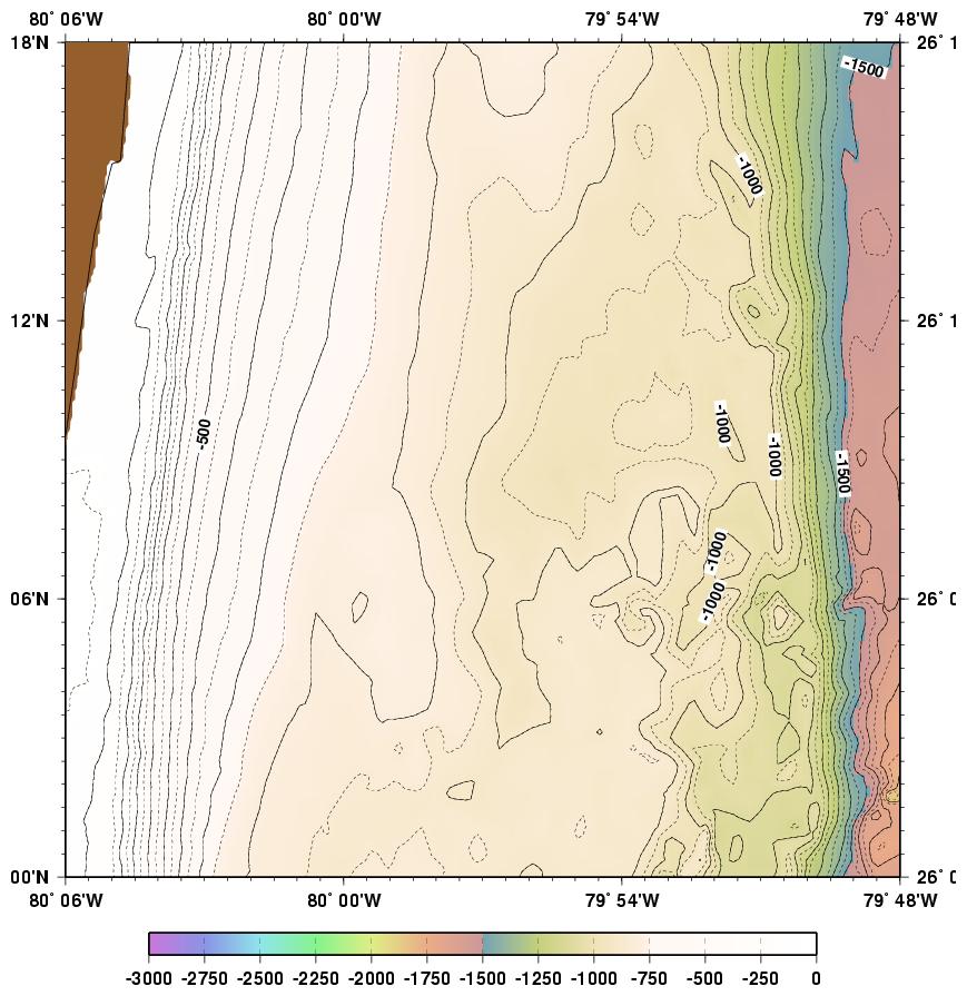
north/west80°06''W 80°00''W 26°18''N 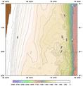
toponw.pdf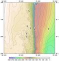
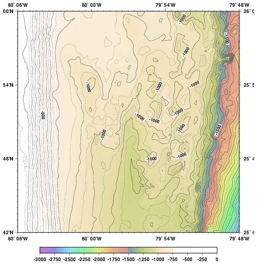
topon.pdf26°00''N 
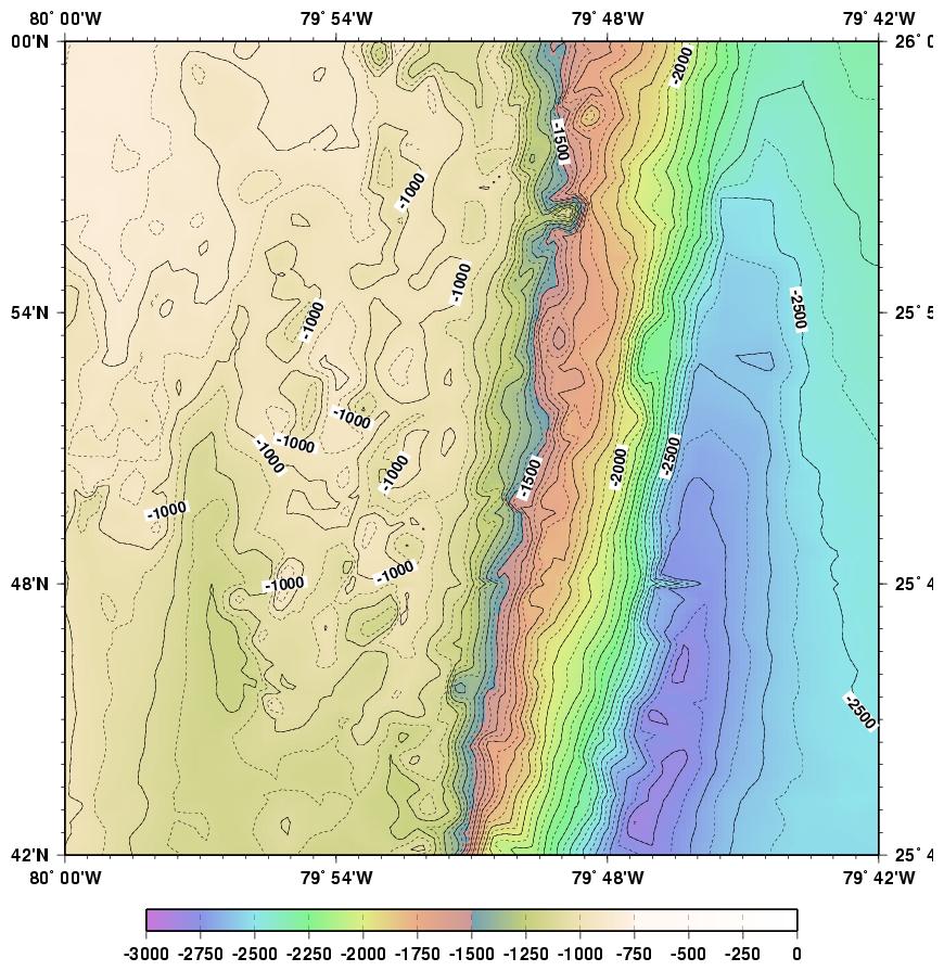
topocw.pdf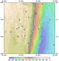
topoc.pdf25°42''N 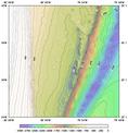
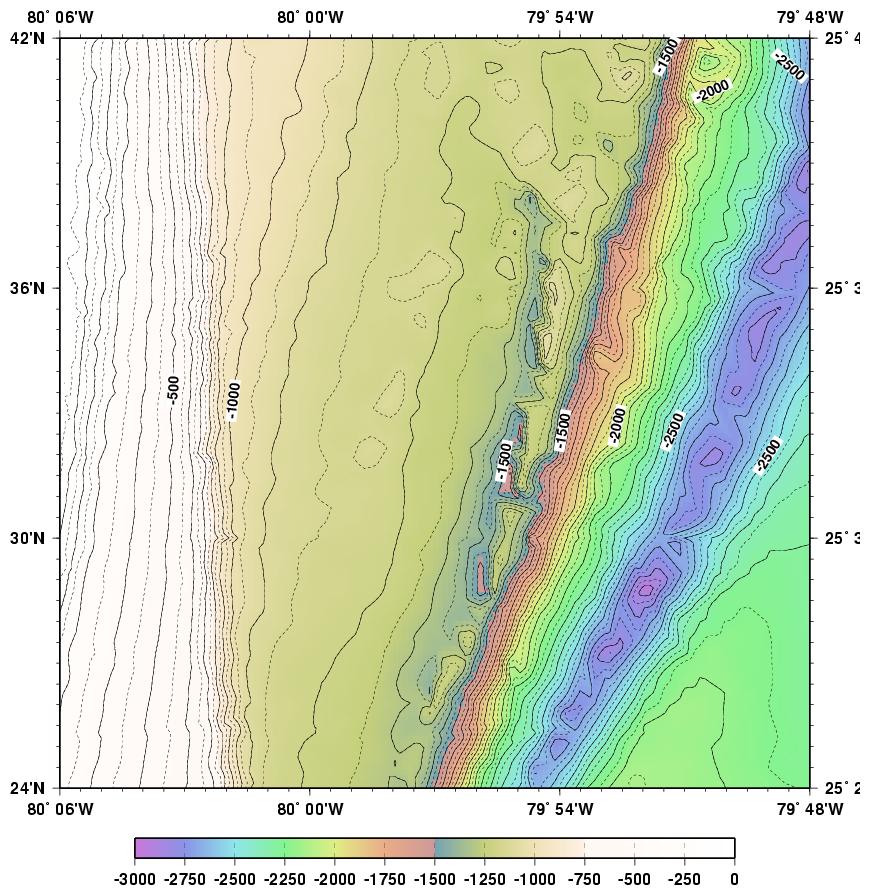
toposw.pd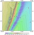
topos.pdf
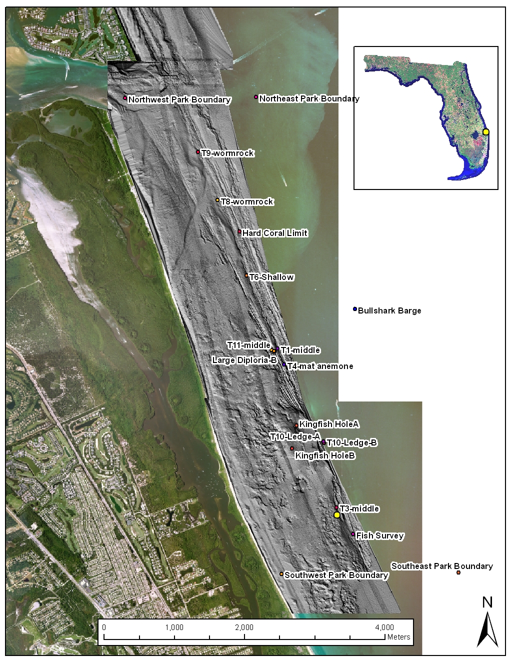
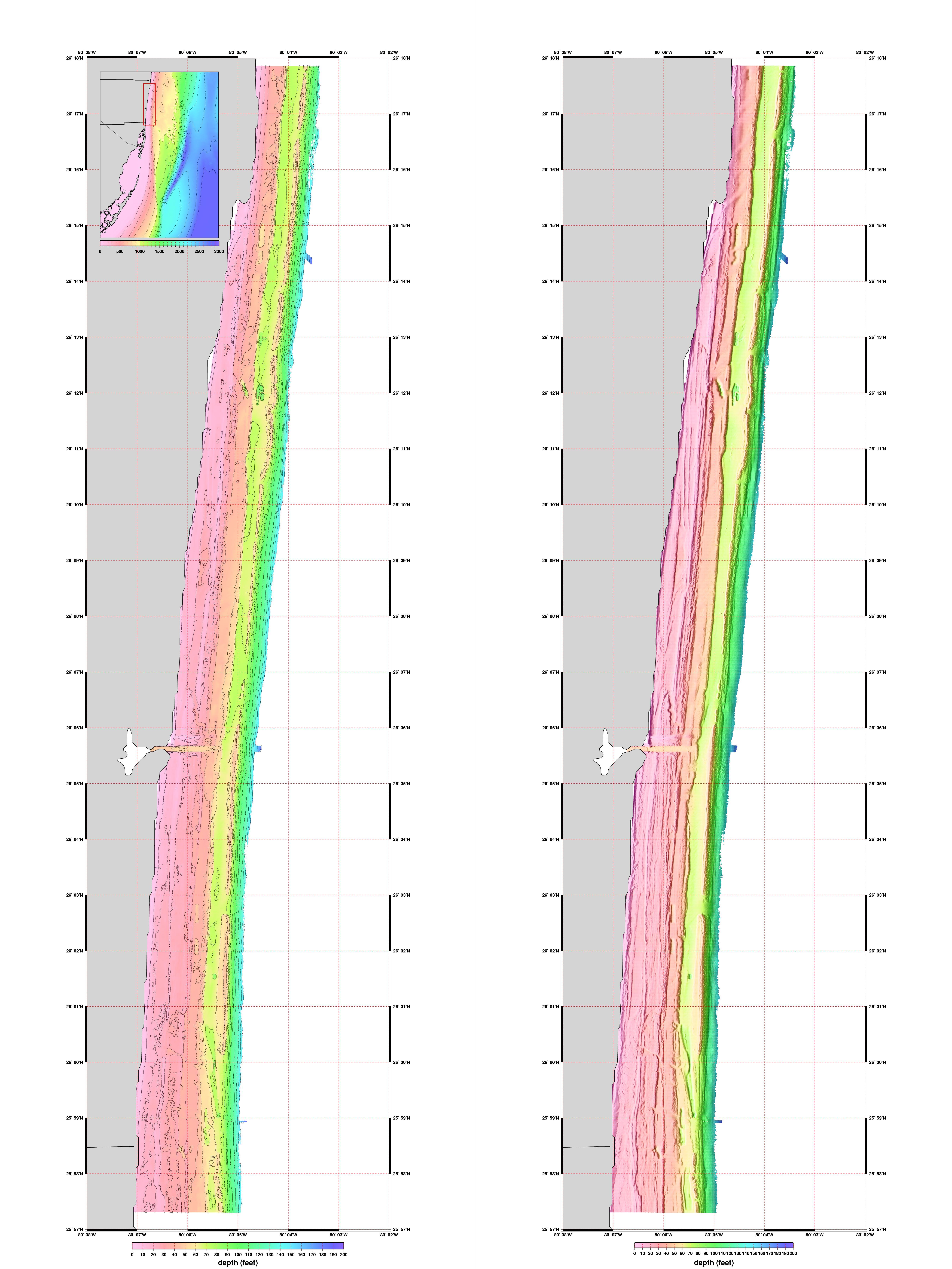
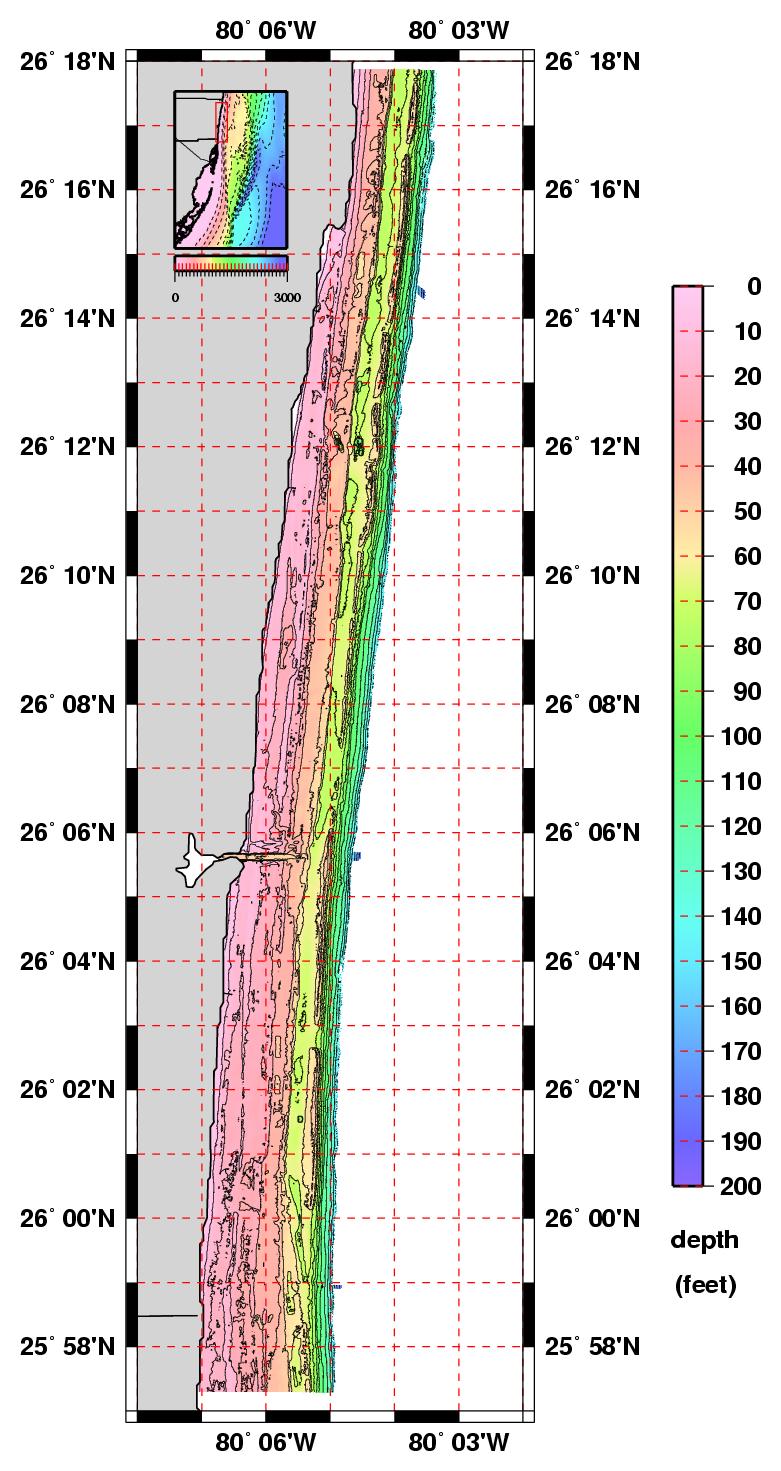
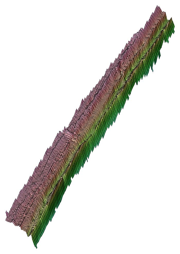
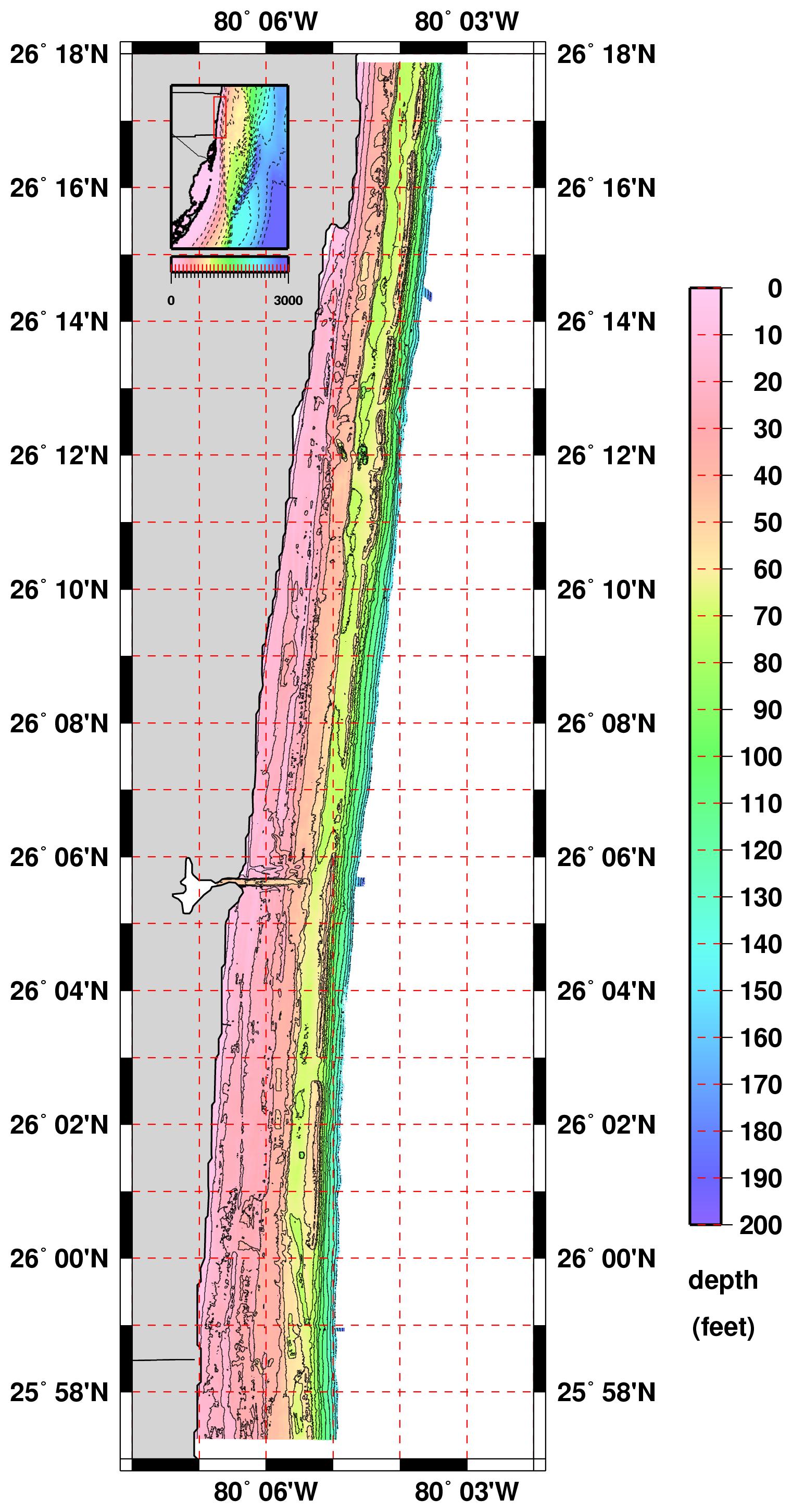
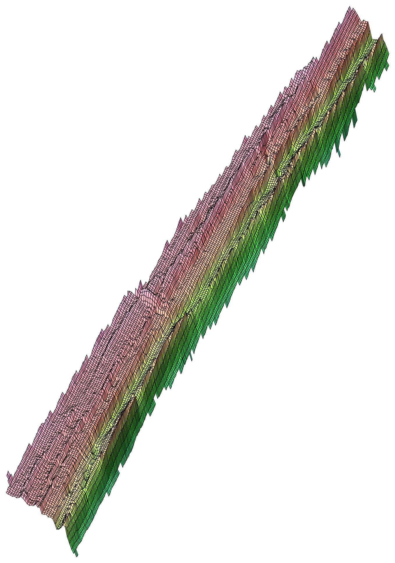
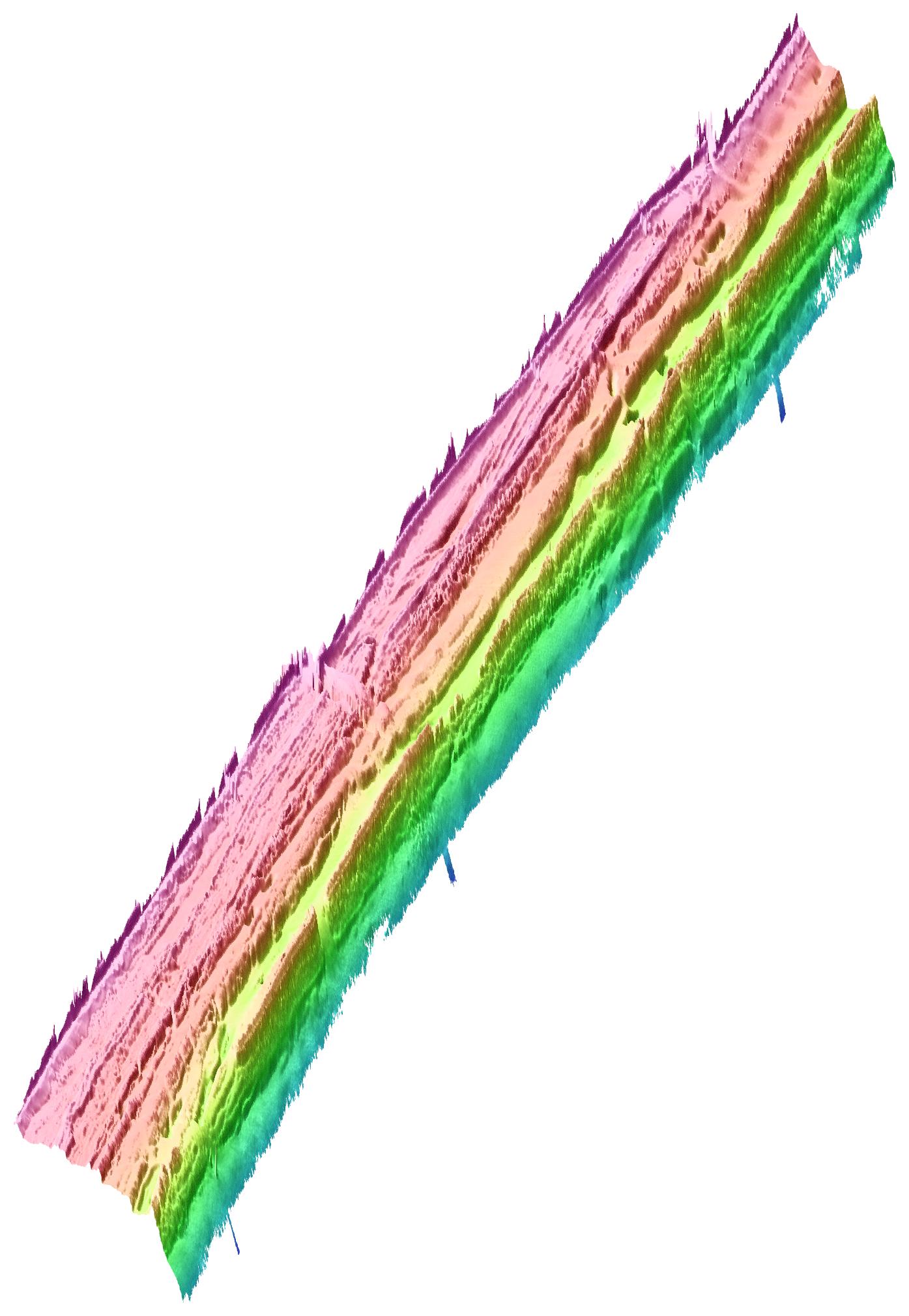
Broward County LADS Bathymetry
(Laser Airborne Depth Sounder)
Click on a thumbnail to load a large (150 dpi) JPG image.
Click on the '300 dpi' link to load a larger (300 dpi) JPG image and
Click on the 'pdf' link to load an Adobe PDF file of the plot.
NOT for navigational purposes.
Poster
flat & shadedSlide Show
3ft x 4ft
(5400x7200)
north lat
(dd.mm)A
(6.0°lon x 3.0°lat)
flatB
(6.0°lon x 3.0°lat)
shaded/meshed 0.00050B
(6.0°lon x 3.0°lat)
shaded 0.00010C
(5.0°lon x 3.0°lat)
flat & shaded/meshedC
(5.0°lon x 3.0°lat)
flat & shadedD
(2.5°lon x 3.0°lat)
flat
300 dpi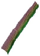
300 dpi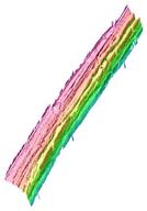
300 dpiThe maps below contain both a plane view in longitude and latitude coordinates and a "3-D" view that is a shifted and compressed view of the plane view. The maps below contain both a plane view in longitude and latitude coordinates and a "3-D" view that is a shifted and compressed view of the plane view. Acknowledgments
LADS bathymetry data was provided by Kathleen O'Keife (Florida Fish & Wildlife Conservation Commission / Fish & Wildlife Research Institute).
These data were collected by Michael W. Janus from Tenix LADS, Inc.


