| ||
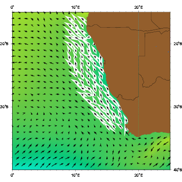
| The Benguela current as represented by the Mariano Global Surface Velocity Analysis (MGSVA). The Benguela Current is the eastern boundary current of the South Atlantic subtropical gyre. The Benguela Current flows through a strong, biologically productive upwelling region, and advects cool waters to the tropics. This water is warmed and is one of the source waters for the South Equatorial Current. Click here for example plots of seasonal averages. | ||
One of the earliest descriptions of the Benguela Current came from James Rennell. In 1832, he described what he called the South Atlantic Benguela Current as flowing north along the western coast of Africa until it reached the equator, where it turned sharply west to become the (South) Equatorial Current. He made a chart of the Atlantic Ocean, but it did not show the current running up to the equator; instead, it showed the current separating from the coast at around 30°S, much like in modern illustrations of the Benguela Current. Apparently Rennell did not discuss this depiction of the current because he would later suggest that cool waters at the equator were transported there by the Benguela Current from cold southern latitudes (Peterson et al. 1996). Modern observations and theory indicate that the cool equatorial waters are due to upwelling induced by divergent Ekman transport.
The sources of the Benguela Current include Indian and South Atlantic subtropical thermocline water; saline, low-oxygen tropical Atlantic water; and cooler, fresher subantarctic water. In the area between the continental shelf and Walvis Ridge it was found that 50% of the source water came from the central Atlantic, 25% came from the Indian Ocean, and 25% came from the Agulhas Current and the tropical Atlantic (Garzoli et al. 1996).
The Benguela Current has a well-defined mean flow that is mostly confined near the continent and a more variable transient flow on its western side. The transient flow is dominated by large eddies shed from the Agulhas Retroflection. Barotropic and baroclinic components are equally important for the mean flow, while the variability is mostly barotropic (Garzoli et al. 1996).
Conceding that the definition of the seaward boundary of the Benguela Current is ambiguous and variable, Shannon (1985) nevertheless observed that there is a well-developed oceanic front in the south. Shannon thus estimated that the Benguela Current was 200-300 km wide. Wedepohl et al. (2000) found that in the south the current indeed has a width of 200 km, but as it flows northward it widens rapidly, becoming as wide as 750 km in the north. The generally weak current flow makes it difficult to precisely locate its seaward edge and strong seasonality in the wind-forcing causes estimates of mean speed and transport, based on in-situ measurements, that can vary by a factor of two.
Shannon (1985) gathered all available information about surface speed from previous studies and calculated the mean speed of the Benguela Current to be 17 cm s-1. Wedepohl et al. (2000) found that the mean speeds of the current vary from <11 cm s-1 to a maximum of 23 cm s-1. Apparently the highest speeds occur in the south during summer and in the north during winter, a pattern that corresponds with seasonal wind fields. The prevailing winds are responsible for strong Ekman transport and the resulting coastal upwelling of cool, nutrient-rich water that stimulates primary productivity (Boyer et al. 2000, Skogen 1999).
There have been several varying estimates of the transport of the Benguela Current. Sverdrup et al. (1942) estimated it to be 18.7 Sv at 30°S relative to 1200 m; Fu (1981) calculated the geostrophic transport at 500 m across 32°S to be 20 Sv; Shannon (1985) obtained the value of 15 Sv; Stramma and Peterson (1989) found it to be 21 Sv at 32°S and 18 Sv at 30°S away from the coast; and Garzoli and Gordon (1996) concluded that it was 13 Sv on average. The value obtained by Garzoli and Gordon (1996) was lower than previous estimates because there is a strong variation of the flow that in a 16-month average results in a lower value.
It had been widely thought that the avearge Benguela transport across 30°S is about 20-25 Sv. However, these values were obtained during hydrographic cruises that only provided a snapshot of the actual flow (Garzoli et al. 1996). The amount of transport across the current is not very variable on a large scale. An analysis of three years of geostrophic transport data from a large-scale array showed that the transport did not change interannually by more than 20% . Greater variability is observed on smaller spatial scales and shorter time scales, especially if there are Agulhas rings nearby (Garzoli et al. 1997).
As a complement to the BEST program (Benguela Source and Transport; Garzoli et al., 1996), and to directly measure the northward flow of intermediate water in the southeastern Atlantic, a new experiment, the Benguela Current Experiment, was conducted during 1997-1999 by P. L. Richardson and S. L. Garzoli. Thirty RAFOS floats were launched in intermediate water at a nominal depth of 750 m across the full width of the Benguela Current near 30°S, across the Benguela Current Extension just upstream of the mid-Atlantic ridge near 7°W, and in three Agulhas rings. The float trajectories (Richardson and Garzoli, 2002) reveal an active, regional mesoscale eddy field consisting of cold-core cyclonic features and large, warm-core, anti-cyclonic Agulhas rings. The mean westward speed of the Benguela Current Extension intermediate water is 2 to 2.5 cm s-1. The boundaries of the Benguela Current Extension were clearly defined at 750 m; the Benguela Current Extension was bounded on the south by 35°S, and on the north by an eastward current located between 18°S and 21°S. Other recent float measurements suggest that this eastward current originates near the Trinidade Ridge, close to the western boundary, and extends across most of the South Atlantic, limiting the Benguela extension from flowing north of approximately 20°S. The westward transport of the Benguela Current Extension is estimated to be 15 Sv. Roughly 1.5 Sv of this is transported by the approximately 3 Agulhas rings that cross the mid-Atlantic ridge each year. Geostrophic shear in the Benguela Current and its extension was very small (1-2 cm s-1), suggesting that this current is only weakly baroclinic. The total westward transport in the Benguela Current Extension above 1000 m and between 18°S-33°S is estimated to be 29 Sv.
A noteworthy phenomenon that can be encountered in the Benguela Current system is the Benguela Niño. Like Pacific El Ninos, Benguela Niños are thought to be a result of anomalous atmospheric conditions in the western tropical Atlantic (Boyer et al. 2000). Every year there is a southward intrusion of warm Angolan water into the northern Benguela, but during a Benguela Niño the Angola-Benguela front is displaced south, causing the advection of warm, highly saline water as far as 25°S (Shannon et al. 1986, Boyer et al. 2000). Three Benguela Niños have been recorded. They occurred in 1934, 1963, and 1984. During the 1963 event temperatures off the coast of Namibia were 2-4°C higher than normal, and the pressure adjusted sea level was 4 cm above the mean. Although Benguela Niños do occur, they are less intense and less frequent than Pacific El Niños (Shannon et al. 1986).