| ||
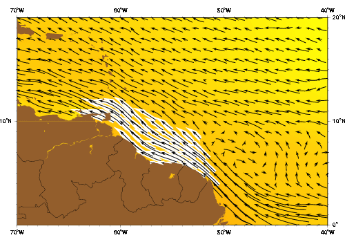
| The Guiana current as represented by the Mariano Global Surface Velocity Analysis (MGSVA). The Guiana current is fed by the North Brazil Current a major source of water for the Caribbean Sea. Water transported by the Guiana current also mixes with tropical waters from the N. Equatorial Current and eventually feeds the circulation of the N. Atlantic subtropical Gyre, via the Caribbean, Yucatan, Loop, and Florida currents. Click here for example plots of seasonal averages. | ||
The Guiana Current surface water enters the Caribbean primarily between the Windward Islands and between Grenada and the South American continent (Gade 1961). Model (1950) inferred from observations made by Pillsbury (1889, 1890) that 70% of the total water volume transported into the Caribbean Sea comes from the Guiana Current (Febres-Ortega and Herrera 1976). The section joining the NBC and the Guiana Current along the coast is marked by a relatively constant flow of 10 Sv (Johns et al. 1990). When the Intertropical Convergence Zone (ITCZ) shifts north, the winds along the Guiana Coast weaken and shift from northeasterly to southeasterly (Met. Office 1948, as cited in Borstad 1982). The change in flow and a reduction of Amazon River discharge after June are correlated with the weakening of the Guiana Current (Fuglister 1951) and a sharp reduction of brackish water supplied to the western tropical Atlantic and Caribbean (Borstad 1982).
Although in the spring the current can extend as far as 300 nautical miles offshore (Febres-Ortega and Herrera 1976), Gade (1961) found that the highest velocities in the Guiana Current occur along the edge of the continental shelf. Fuglister (1951) calculated the variations in current speed. The mean speed was 41.6 cm s-1 and had an annual range of 30.0 cm s-1. This maximum speed occurred in April-May, while the minimum occurred in September due to the migration of the ITCZ and the accompanying variations in the Trade Winds (Febres-Ortega and Herrera 1976). Boisvert (1967), using more than 20000 ship drift observations, concluded that the Guiana Current is strong and persistent. He observed the speed to vary between 0.2 and 4.2 knots (10 to 216 cm s-1), although the majority of observations (80-85%) were in the range between 0.8 and 2.4 knots (41 to 123 cm s-1) (Febres-Ortega and Herrera 1976).
In 1966, Cochrane suggested that the current is not continuous, but composed of a succession of westward limbs of eddies (Metcalf 1968). Some years later, Venezuelan researchers (Fukoka 1971, Febres-Ortega 1974) used stations approximately 100 km apart on grids along the northeastern South American coast to conduct ship surveys of the Guiana Current. They detected seemingly continuous meanders in the core of the current in July-August 1968, April 1970, and April and November of 1972 (Borstad 1982). Based on these observations, Fukoka (1971) concluded that the Guiana Current does not flow uniformly northwestward because the meanders, with wavelengths of 500 to 600 km, are superposed on the current (Febres-Ortega and Herrera 1976). The meanders in the Guiana Current have been attributed to bathymetric influence, Rossby waves, water pileup against the Lesser Antilles, and variations in winds and river runoff (Fukoka 1971, Mazeika 1973, Febres-Ortega 1974, Febres-Ortega and Herrera 1976).
Several researchers (Ryther et al. 1967, Metcalf 1968, Cochrane 1969, Gibbs 1970) have noted the presence of fresh water lenses in the Guiana Current. These lenses originate as lobes extending from the Amazon River. They gradually separate from the river and expand as they move offshore and mix with seawater. Typically they have diameters on the order of 300 km, they can be 20 to 50 m deep, and they have negative salinity anomalies of as much as 9 psu (Flagg et al. 1986). How the lenses cross the Guiana Current has been the subject of some speculation. Ryther et al. (1967) suggested that the lenses may be released when the Guiana Current weakens due to slack winds. Metcalf (1968) proposed that the lenses escape through a discontinuity between the NBCC and the Guiana Current, and through discontinuities between series of meanders. Gibbs (1970) said that perhaps the fresh water builds up near the shore until it forms a very large lobe that makes its way across.
The general consensus until 1968 was that the Guiana Current flowed mostly unchanged along the northeastern coast of South America and into the Caribbean Sea. It was then that Metcalf (1968) argued on the basis of the formation of the Equatorial Undercurrent, the pattern of the subsurface-salinity maximum along the Brazilian coast, the distribution of lenses of the Amazon River outflow, and the lack of South Atlantic Central water in the Caribbean Sea that the picture was actually more complicated. Since the make-up of the water column changes near the Amazon River mouth, Metcalf and Stalcup (1967) suggested limiting the use of the term North Brazilian Coastal Current to the area southeast of this region, while using the term Guiana Current to refer to the section along the Guiana Coast (Metcalf 1968).